This datasets gives an overview of the Nauru Island Landcover, with country-level summary of the different landcover classes and designation. From spatial maps and GIS related datasets for state of the environment reporting.
Feature Image
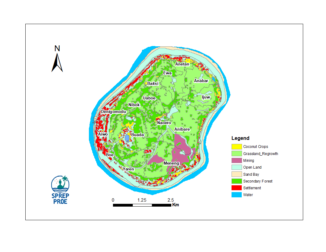
This datasets gives an overview of the Nauru Island Landcover, with country-level summary of the different landcover classes and designation. From spatial maps and GIS related datasets for state of the environment reporting.