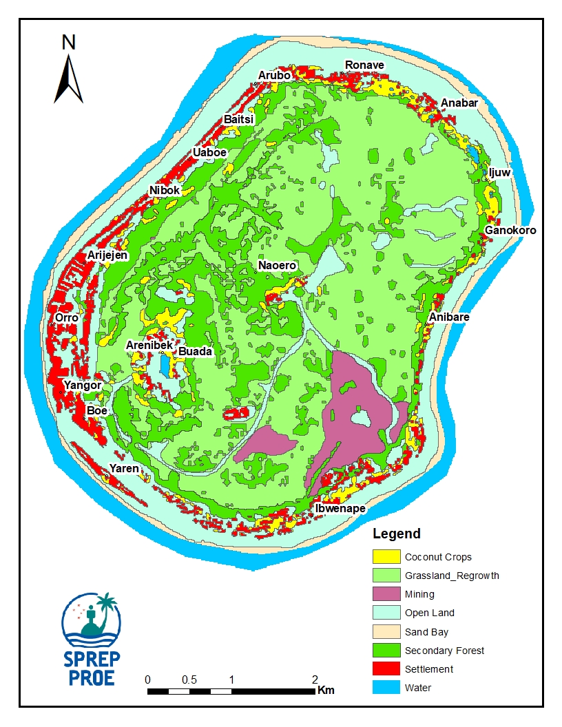
Map of the Nauru island landcover, with…

The Nauru Department of Commerce, Industry and Environment has oversight and responsibility over issues concerning the environment, climate change, and commerce.
License
Map of the Nauru island landcover, with country-level summary of the different landcover classes and designation.
Data and Resource
| Field | Value |
|---|---|
| Publisher | Nauru Department of Commerce, Industry and Environment, Secretariat of the Pacific Regional Environment Programme (SPREP) |
| Modified | |
| Release Date | |
| Identifier | af7a90b8-42b2-4704-a3d1-64e710db24bb |
| Spatial / Geographical Coverage Location | Nauru Island |
| Relevant Countries | Nauru |
| Language | English (Canada) |
| License |
SPREP Public Licence
![[Open Data]](https://assets.okfn.org/images/ok_buttons/od_80x15_blue.png)
|
| Author | SPREP |
| Contact Name | Vani Koroisamanunu |
| Contact Email | [email protected] |