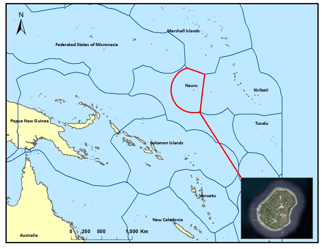
The map shows Nauru Island EEZ boundary.
The Nauru Fisheries and Marine Resources Authority (NFMRA) is the official body responsible for the management of fisheries and other marine resources of the Republic of Nauru.

The Nauru Department of Commerce, Industry and Environment has oversight and responsibility over issues concerning the environment, climate change, and commerce.
License
This dataset shows the Nauru Exclusive Economic Zone Boundary (EEZ) in relation to the Pacific Islands EEZ boundaries.
| Field | Value |
|---|---|
| Publisher | Nauru Fisheries and Marine Resources Authority (NFMRA), Nauru Department of Commerce, Industry and Environment |
| Modified | |
| Release Date | |
| Identifier | 707cef3a-565a-4b90-abd1-29534f444066 |
| Spatial / Geographical Coverage Location | Nauru Island |
| Relevant Countries | Nauru |
| Language | English (Canada) |
| License |
SPREP Public Licence
![[Open Data]](https://assets.okfn.org/images/ok_buttons/od_80x15_blue.png)
|
| Author | SPREP |
| Contact Name | Vani Koroisamanunu |
| Contact Email | [email protected] |